
Mapping Our Own Communities: 31 Young People Embrace Drone Technology in Blantyre
Young people from three informal settlements in Blantyre are gaining new digital skills and discovering fresh ways to understand, document and map their communities through a training organised by CCODE in collaboration with the Humanitarian OpenStreetMap Team (HOT).
For six fast-paced days, 31 energetic participants stepped out of classrooms and straight into the future. Implemented under the SDI III Impact Innovation Initiative, CCODE collaborated with HOT to lead expert training. Together, they taught digital mapping and drone operations across Bangwe, Mbayani, and Ndirande. Crucially, the hands-on sessions included the actual mapping of Bangwe. But why wait for foreign experts or top-down projects to define local needs? Instead, trained local youth can map their own streets. By mastering drone flight and digital mapping, these young mappers prove a key point: local knowledge, not distant bureaucracy, drives real urban development.
Learning the Basics of Drone Technology
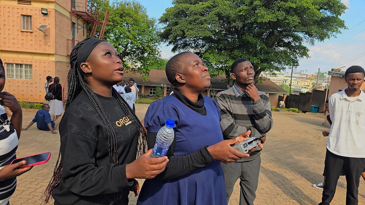
First, day one hit the ground running with hands-on drone teardowns and direct flight controls. Instead of staring at abstract diagrams, participants immediately unpacked real hardware. As a result, they directly saw how aerial data challenges traditional, outdated urban planning.
The energy in the room skyrocketed the moment the propellers started spinning. Steering a high-tech drone manually isn’t just exciting, it radically changes how you see your own neighbourhood.
For young content creators and media enthusiasts in the cohort, this was a gamechanger. They seamlessly turned their storytelling instincts into spatial data collection, taking control of technology that mainstream industries often keep out of reach.
Seeing the Community from a Different Perspective
For example, consider Lewis Kachembere from Ndirande. For years, steep commercial costs barred him from accessing drone tech. Consequently, powerful mapping tools remained strictly in the hands of high-priced consultants.
Fortunately, this training shattered that barrier. Watching a live aerial feed of his own streets instantly reshaped his perspective. Indeed, it transformed how he views Ndirande’s potential and its right to better infrastructure.
However, it wasn’t just about flying a cool gadget. Furthermore, Lewis connected drone mapping with his business background. This spark inspired ideas for knowledge entrepreneurs and community-led ventures that boldly challenge standard development models.
His story sparks a critical question: how much local talent is sitting untapped simply because traditional institutions gatekeep emerging technology?
Taking Learning into the Field 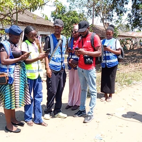
Of course, theory means little without action. Therefore, the team launched directly into field operations across Bangwe, Ndirande, and Mbayani. In turn, they captured precise aerial data where official maps often leave blank spaces.
Over six intensive days, these young pilots navigated real-world field conditions, converting raw flight data into actionable maps that reflect authentic community boundaries.
By mapping their own neighborhoods, participants shifted from passive observers to active drivers of change. They know every alleyway and flood-prone pocket better than any outside authority ever could.
This hands-on work exposed a key truth: top-down urban planning fails when it ignores the people living on the ground. Real progress starts when residents document their own reality.
 Exploring OpenStreetMap Tools with HOT
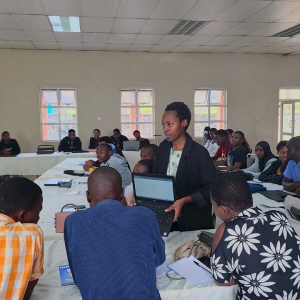
Under the SDI III Impact Innovation Initiative, CCODE brought in HOT to lead specialized sessions. Specifically, they focused on open-source mapping platforms like ChatMap and uMap. In doing so, they handed youth in Bangwe, Mbayani, and Ndirande the keys to global geospatial tools.
These intuitive platforms turn raw field data into powerful visual arguments, allowing youth to broadcast local needs straight to international policy makers.
The core takeaway? Informal settlements aren’t problems to be managed from afar; they are vibrant communities full of young leaders ready to demand visibility.
Ultimately, this initiative proves that mapping doesn’t belong exclusively to government agencies or expensive firms. On the contrary, local youth can and should lead the narrative.
Combining drone technology, open-source software, and grassroots data collection creates an unstoppable force for community-led advocacy.
Six Days of Learning, Mapping and Discovery
Across six intense days, these 31 young innovators transformed from tech novices into fully equipped digital mappers.
In short, they didn’t just learn how to fly hardware. Above all, they reclaimed spatial ownership of Bangwe, Ndirande, and Mbayani.
Beyond tech skills, this project proves a broader point. Young people are ready to lead digital innovation as knowledge entrepreneurs while directly challenging traditional, slow-moving urban development practices.
Building a New Generation of Community Mappers
Under the SDI III Impact Innovation Initiative, CCODE brought in HOT to train youth across Bangwe, Mbayani, and Ndirande. Ultimately, this demonstrates what happens when organizations stop treating young people as passive beneficiaries and instead equip them with real technical tools.
For these 31 mappers, the journey goes far beyond flying drones. Indeed, it’s about demanding recognition and driving real change across Blantyre.
Will traditional authorities listen to the data these young mappers produce, or will youth-led tech continue to outpace old ways of governing? One thing is clear: the new generation of mappers isn’t waiting around for permission.

