Youth Are Not Just the Future; They Are Part of the Solution Now.
When young people in Mtandire learn to operate drones, they are gaining more than a technical skill. They are helping generate evidence that could support healthier, safer and more climate-resilient communities.
Climate change, rapid urbanisation and inadequate infrastructure are increasing health risks in Malawi’s informal settlements. In densely populated communities such as Mtandire, flooding, poor drainage, unsafe water and waste accumulation can create conditions that increase vulnerability to diseases such as cholera.
To strengthen understanding of these risks, the Centre for Community Organisation and Development (CCODE) is implementing the “Revolutionising the Use of Geospatial Data for Climate-Related Health” project, funded by the Wellcome Trust. The project uses drone technology to collect high-resolution geospatial information that supports climate and health planning, including efforts to better understand environmental conditions associated with cholera risk.
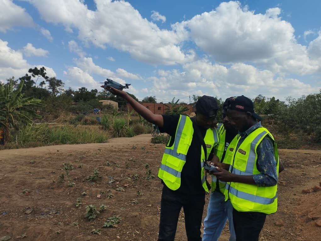
Young people are playing an active role in this work. They are being trained and involved in drone mapping to help collect information about their communities and contribute to the development of locally relevant solutions.
Young People Behind the Technology
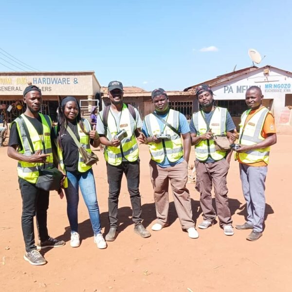
In Mtandire, 7 young people have been involved in the drone mapping process, including 5 young men and 2 young women.
The participants have learned how to plan drone flights, operate drones and support the collection of aerial imagery. Their involvement creates an opportunity for young people to move beyond being users of technology and become active contributors to data collection and community planning.
For Jacqueline Kabungwe, one of the young people involved in the training, the experience has opened new possibilities.
“The drone mapping training was exciting and empowering. It showed me how technology can be used to understand and address community challenges.”
For Jacqueline, the experience also challenged assumptions about who belongs in spaces of technology and innovation.
“The experience gave me confidence and showed me that as a young woman, I can also take the lead in technology and innovation, using these skills to address community challenges and create meaningful change.”
Her experience reflects the project’s broader approach: equipping young people with practical skills while creating opportunities for them to contribute to challenges affecting their own communities.
From Mapping to Health Action
The drone mapping exercise is intended to provide a detailed view of environmental conditions across Mtandire. From above, features such as drainage channels, water points, areas affected by flooding and waste accumulation can be identified and analysed alongside other settlement information.
According to Bertha Phiri, Technical Support Officer, the drone mapping component aims to generate high-resolution imagery that will support planning and service delivery.
The project expects to produce high-resolution drone imagery, three-dimensional settlement models and geospatial datasets covering features such as water infrastructure, drainage systems and climate exposure sites.
The connection to cholera prevention lies in how this information will be used.
Environmental information collected through drone mapping will be combined with public-health and community-level information to identify areas where risks may overlap. For example, mapping will help show where flooding occurs near water points, where drainage systems are inadequate or where waste accumulates in densely populated areas.
When combined with information on disease patterns and other public-health risks, this evidence can help stakeholders identify priority areas for interventions such as improved drainage, waste management, water and sanitation services and targeted health responses.
The mapping itself does not prevent cholera. Its potential value lies in helping communities, local authorities, health actors and other stakeholders make better-informed decisions about where interventions may be most urgently needed.
Innovation Meets Reality
Learning and applying new technology have also brought practical challenges.
Some participants experienced difficulties connecting their phones to the drone controller, while access to suitable computers was limited. At times, the team relied on one computer to transfer and manage flight plans, requiring participants to work together and adjust their approach.
For Jacqueline, these challenges became part of the learning process.
“It taught me that teamwork and patience are important, especially when things don’t go as planned. We learned from each other and kept going until we achieved our goal.”
The experience demonstrates that introducing digital tools into community development requires more than equipment. It also requires access, teamwork, practical support and opportunities to learn through challenges.
Communities and Data Must Be Protected
Drone mapping in a densely populated settlement requires strong attention to safety, privacy and community trust.
The project team has taken steps to ensure that drone operations comply with relevant safety and regulatory requirements. According to Bertha, the drones have been registered with the department survey under the ministry of Lands, Housing and Urban development, while authorisation has also been obtained the Malawi Civil Aviation Authority (MCAA) for regulating drone operations.
During flights, safety procedures are followed and an observer monitors the drone to help reduce risks to people and property.
However, responsible data collection extends beyond flight safety.
As the project generates detailed imagery of communities, careful consideration is required around community awareness, consent, privacy, data storage, ownership and access. Identifiable households and individuals must be protected, and the collection and use of data should be guided by clear safeguards.
Residents also have an important role to play in ensuring that maps reflect the realities of the community. Community knowledge can help identify environmental risks, interpret mapped information and inform discussions about how the data should be used.
This combination of technical information and local knowledge is essential. Aerial imagery can show what is visible from above, but residents understand how flooding, water access, drainage and waste challenges affect daily life.
What Has Been Achieved and What Comes Next
The project has already begun building the capacity of young people to participate in drone mapping, with seven young people involved in the Mtandire exercise. Participants have gained practical exposure to drone operations and the collection of geospatial information.
The project is currently using this approach to generate detailed information about settlement conditions.
The next stage is to ensure that the information collected is analysed alongside community and public-health data and translated into practical action. The project expects the resulting imagery, models and datasets to support planning, advocacy and decision-making around climate-related health risks.
For Jacqueline, the experience has also delivered a message to other young people.
“Don’t be afraid to learn and try new technologies. Your ideas and skills can create real change in your community.”
The experience in Mtandire shows what can happen when young people are given access to knowledge, technology and meaningful opportunities to participate.
Drones may provide a new perspective on the physical conditions of a settlement, but the long-term value will depend on what happens after the flights are completed: how the information is protected, interpreted, shared and used.
If the resulting evidence helps communities and decision-makers identify environmental health risks earlier and target interventions more effectively, drone mapping could become an important tool in strengthening climate resilience and supporting efforts to prevent diseases such as cholera.
Youth are not just the future; they are already part of the solution now.
